Quick Grid and Contour Properties
To define the quick grid and contour properties, use this page, which
you can open using the icon ( ![]() )
or from the Tools menu.
)
or from the Tools menu.
Properties Options
Gridding
|
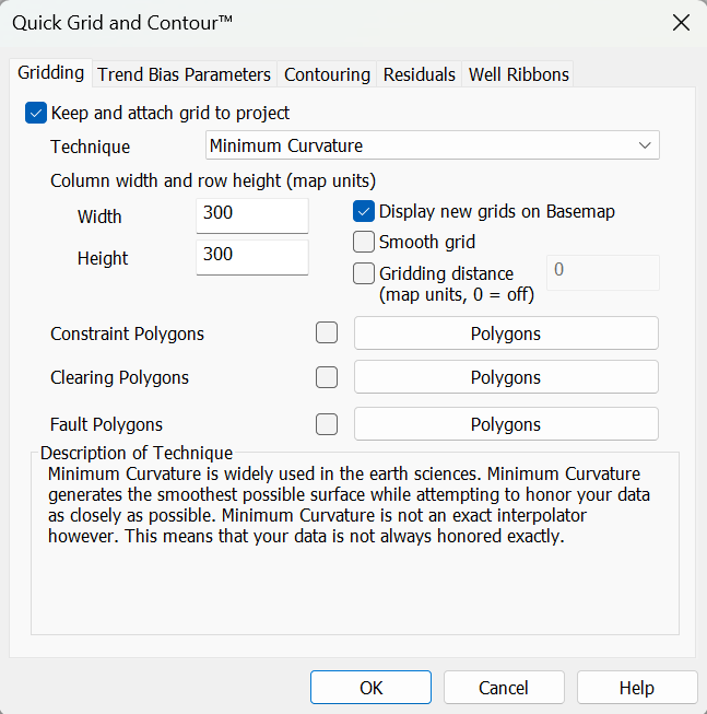
Keep and
attach grid to project: This
determines if gridding is to be performed, and if the result is to be
attached. It is possible that gridding will still occur if this check
box is off (e.g. for computing a residual) though the results will not
be saved. Technique: Select the desired algorithm. A brief description of the algorithm is provided under "Description of Technique". For more information refer to the Gridding Techniques in the Grid and Contour help. Column width and row height: Specify the column width and row height in map units. this is either meters or feet depending on the coordinate system being used. Smooth grid: Enable this to use a smoothing algorithm to eliminate spikes in the grid. Gridding distance: The farthest distance the output grid will extend from any seed data point. When gridding 2D data or irregular 3D data this can be used when you don't want to fill in all the gaps. This value is specified in map units, usually meters. Constraint Polygons (optional): Use this option to specify a region of seed points to use for the grid. If using an Inclusion/Constraining Polygon only the seed points within the polygon will be used to create the grid. If using an Exclusion/Constraining Polygon only the seed points not within the polygon will be used. This polygon will not affect the size or shape of the output grid. Clearing Polygons (optional): Once the grid is created this polygon will be applied to clear parts of the grid. If using an Inclusion/Constraining Polygon all parts of the grid will be cleared except for what is within the polygon. If using an Exclusion/Constraining Polygon everything will be kept except for what is in the polygon. Fault Polygons (optional): Use this option to define fault regions. When gridding seed data points that are across a fault they are ignored and not used to determine grid values. |
Trend Bias
|
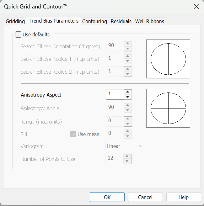
Use
defaults: When searching for
a set of points to consider when
calculating the value for a grid node, this option tells it to search
within a circle where the radius is one half the distance of the grid
diagonal. When using Kriging as the gridding method, you can specify the Search Ellipse and Anisotropy independently to skew the resulting grid. For information on all parameters see the Anisotropy and Search Options page in Grid and Contour. |
Contouring
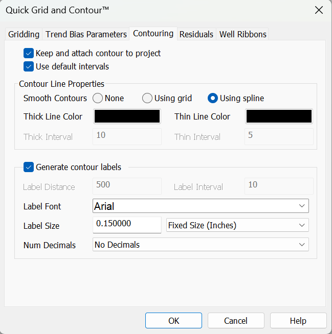 | Keep and
attach contour to project: If
the check is off, no contouring
will occur. If contouring is necessary for an internal operation the
results will not be preserved. Use default intervals: If toggled on, the software will estimate an appropriate contouring interval. Turn off to manually specify the contouring intervals. Smooth Contours: Indicates whether the contour should be smoothed or not. A smoothed contour will have more control points in it. You have the option to smooth a contour using a spline or using a grid method. When using a grid to smooth the line, the original grid is resized to 5 times its original size and then the contours are generated as normal, which produces a smoother line because the grid is finer. Using a grid to smooth the contours means that you will not get overlapping contours or loops happening where there are cusps in the contour line. Label Interval: Interval value for each contour to be labeled. Typically, users set this to the same value as "Thick Interval". It is a good idea to set this to a multiple of "Thin Interval". |
Residuals
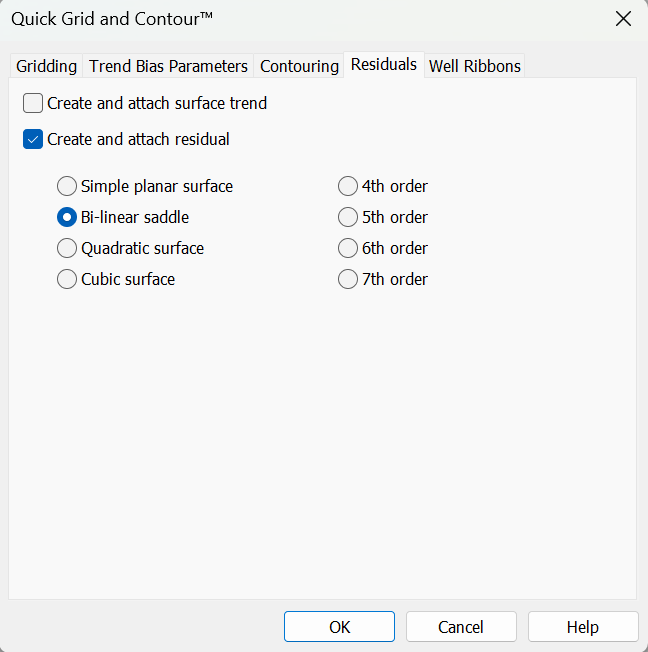 | Create
and attach surface trend: This
option creates a trend surface.
The trend surface is calculated using a polynomial regression algorithm
to create a smooth surface that approximates the seed points. The
higher the order of the polynomial used, the more closely the trend
surface will match the seed points. Create and attach residual: A residual surface is the difference between the trend surface and the gridded surface. The residual surface can show anomalies between the gridded surface and the trend surface. Trend surface polynomial order: The order of the polynomial that will be used in generating the trend surface. The higher the order, the more closely the trend surface will match the seed points. Also, the higher the order, the longer it will take to calculate the trend surface. |
Well Ribbons
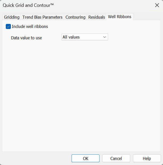 | Include
well ribbons To grid
and contour well ribbons in conjunction
with the seismic data, ensure that this is checked on. Any Value: In the case of multiple well tops values, a random one will be used. Shallowest value: In the case
of
multiple well tops values, only the shallowest one will be used. Sum values: In the case of multiple well tops values, they will be summed. Average values: In the case of multiple well tops values, the average value will be used. |
Also See
— MORE INFORMATION

|
Copyright © 2020 | SeisWare International Inc. | All rights reserved |