Link Culture: Extents
Use the Extents page to optionally limit the culture to a specific geographical region or objects found within a polygon. Often layers are much larger than the project area of interest, and setting areal restrictions can make the project easier to maintain.
Note: Objects that are found entirely outside the bounds selected on the page will be clipped, while objects that are at least partially within the area will be linked. This means that a line that crossed a boundary will not be clipped.
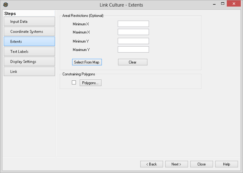
Areal Restrictions
Set the restriction using X and Y values entered manually, or selected
from the Basemap.
Minimum
X: Specify the far left point to clip
against in map units.
Maximum
X: Specify the far right point to clip
against in map units.
Minimum
Y: Specify the bottom point to clip
against in map units.
Maximum
Y: Specify the top point to clip
against in map units. Select
From Map: Click this button and then
select an area on the Basemap by dragging out a rectangle over your
area of interest. If you have accidentally clicked on this
button, click on it again to stop the map selection.
Select
From Map: Click this button and then
select an area on the Basemap by dragging out a rectangle over your
area of interest. If you have accidentally clicked on this
button, click on it again to stop the map selection. Clear:
Clear the
optional area restrictions.
Clear:
Clear the
optional area restrictions.
Constraining Polygons
 Polygons:
Open the Select Polygons
dialog to select inclusion or exclusion polygons to define the
limits of the volume.
Polygons:
Open the Select Polygons
dialog to select inclusion or exclusion polygons to define the
limits of the volume.
— MORE INFORMATION

|
Copyright © 2020 | SeisWare International Inc. | All rights reserved |