Field Development Tool: Raster Properties
The Raster Properties window is used to view, copy, paste, and delete the raster images in your project.
Note: If you are using Field Development Tool with Geology or Geophysics, this window will not be available. Please use the tools found on the Main Launcher.
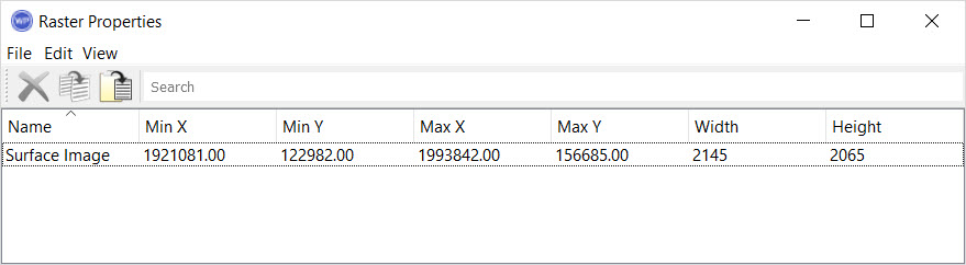
Column Descriptions
The following columns can be displayed in the data table. Left click on any column heading to sort the table using the data in that column. Right click on the column header to open the shortcut menu.  Shortcut menu options...
Name:Name of the raster image.
Owner: The owner of the raster file.
Description:A description of the raster image. This can be entered when you import the image.
Filename:The fie location associates with the image.
Width: The width in pixels of the image.
Height:The height in pixels of the image.
Min X: The minimum X coordinate of the image. This will be the left side of the image.
Min Y:The minimum Y coordinate of the image. This will be the bottom side of the image.
Max X:The maximum X coordinate of the image. This will be the right side of the image.
Max Y:The maximum Y coordinate of the image. This will be the top side of the image.
Menus
The menus at the top of the window contain tools to delete, copy, and paste raster images, and customize the appearance of the window.
File Menu: Exit the properties window.
Edit Menu: Access tools to delete, copy, paste, and select data items. Right click in the table to access these tools from a shortcut menu. See Edit menu options...


View Menu: Turn the toolbars on and off, and select the columns to display. See View menu options...
Toolbars
The Edit Toolbar allows you to quickly delete, copy, paste, and search for grids. Right click in the table to access these tools from a shortcut menu. See Edit Toolbar options...

— MORE INFORMATION

|
Copyright © 2020 | SeisWare International Inc. | All rights reserved |