Merge Grids: Grid Properties
The Grid Properties page lets you specify the shape and spacing of the output grid, and optionally select inclusion or exclusion polygons to limit the data points that are merged into the output grid.
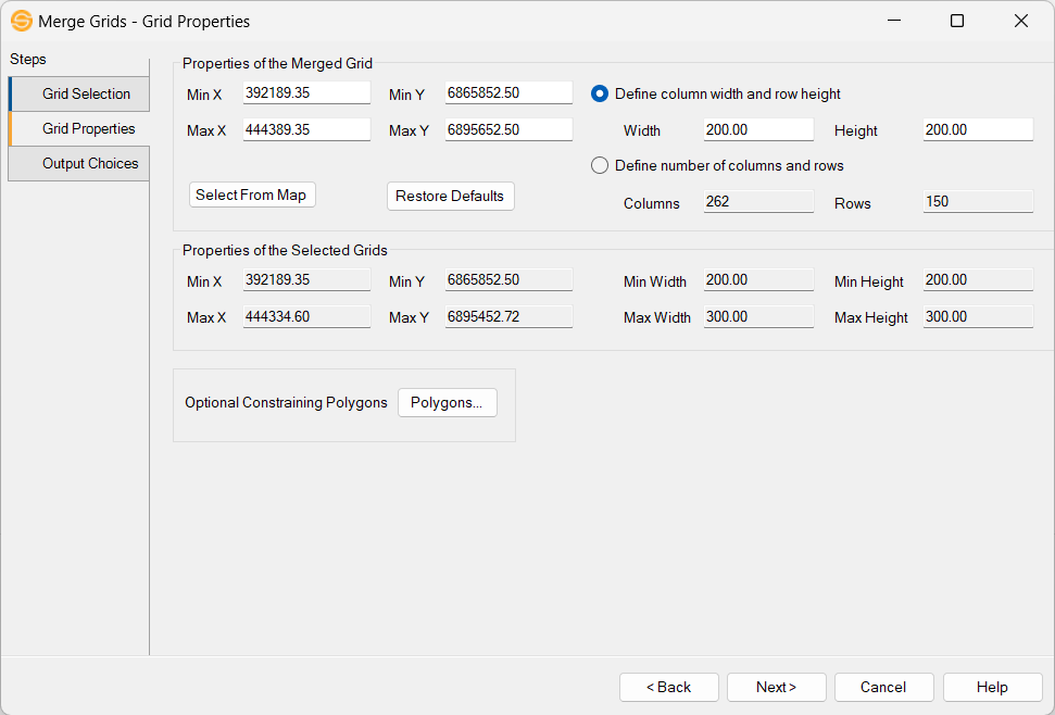
Properties of Merged Grid
Enter the properties that you want for the merged grid. The fields are
populated using the maximum values obtained from the selected grids,
but can be overwritten.
Min X,
Min Y, Max X, Max Y:
Displays the coordinates of the shape of the output grid which will be
created. To set the extents, these fields may be edited, or
the extents may be selected on the map. The fields
default to the smallest rectangle that contains all of the grids that
will be merged. The Max X and Max Y values will be changed
when the column and row spacing is changed, to ensure that the grid
edges contain data values.
Select From Map:Click Select From Map and then define the Min X, Min Y, Max X and Max Y extents by dragging our an area on the Basemap with the left mouse button depressed.
Restore Defaults:Changes the extents defined in Min X, Min Y, Max X, and Max Y to the smallest rectangle that contains all of the grids that will be merged.
Define column width and height: Select this option if you prefer to set the column width and row height by entering those values into the Width and Height fields.
Width:Enter the distance between columns of data in the output grid.
Height: Enter the distance between rows of data in the output grid.
Define number of columns and rows: Select this option if you prefer to set the number of columns and rows of data. The width and height will be calculated based on the extents of the grid and the number of columns and rows.
Columns: Enter the number of columns of data in the output grid.
Rows:Enter the number of rows of data in the output grid.
Properties of Selected Grids
These values cannot be edited, but you can use them to determine the best properties for the merged grid output.
Min X, Min Y, Max X, Max Y: Displays the coordinates of the smallest rectangle that contains all of the grids that will be merged.
Min Width:Displays the smallest distance between the columns of all of the grids that will be merged.
Min Height: Displays the smallest distance between the rows of all of the grids that will be merged.
Max Width: Displays the largest distance between the columns of all of the grids that will be merged.
Max Height: Displays
the largest distance between the rows of all of the grids that will be
merged.
Optional Constraining Polygons
 Polygons:
Open the Select
Polygons dialog
and select inclusion or exclusion
polygons to restrict the geographical extents of the grid merge. Only
points within the
constrained zone will be merged, and any points in the destination grid
outside of the polygon constraints will remain unchanged.
Polygons:
Open the Select
Polygons dialog
and select inclusion or exclusion
polygons to restrict the geographical extents of the grid merge. Only
points within the
constrained zone will be merged, and any points in the destination grid
outside of the polygon constraints will remain unchanged.
— MORE INFORMATION

|
Copyright © 2020 | SeisWare International Inc. | All rights reserved |