Data Pipeline: Area Definition
The Area Definition page allows you to set up the area of interest
to use
to
retrieve the data.
You can type it in or select an area on the Basemap window.
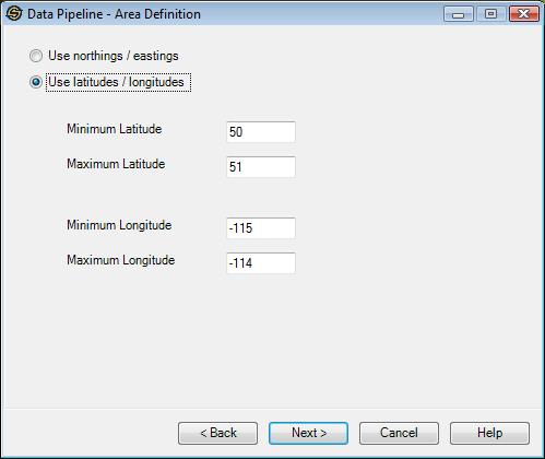
Use Northings / Eastings:This specifies that the area definition will be provided will be in XY coordinates. If you select the area from the Basemap, it will always be in XY coordinates.
Use Latitudes /
Longitudes: This specifies that the area definition will
be provided in
latitude/longitude coordinates. The latitudes
must be between 90 and -90 degrees and the longitudes must be between
180 and -180 degrees.
Note: Depending on the Data Source selected and the Data Types to import not all pages may appear.
— MORE INFORMATION

|
Copyright © 2020 | SeisWare International Inc. | All rights reserved |