Time/Depth Velocity Modeling: Bounds
The settings on the Bounds tab in the Time/Depth Properties dialog box determine the extents of the output grid.
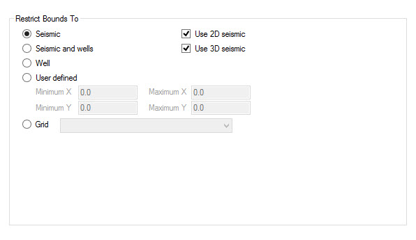
Restrict Bounds To
Select the method you want to use to determine the extents of your output grid. The size and shape of the final grid are also dependent on the polygons selected on the Polygon Options tab in the Layer Details dialog box.
Seismic
Data: The extents of the output grid will be determined by the maximum extents of the seismic data selected on the Select Seismic tab. You also need to select Use 2D Seismic and/or Use 3D seismic when using this option.
Seismic and Well Data: The extents of the output grid will be determined by the maximum extents of the seismic data selected on the Select Seismic tab, and the wells selected in the Select Wells tab. You also need to select Use 2D Seismic and/or Use 3D seismic when using this option.
Well Data: The extents of the output grid will be determined by the maximum extents of the well data selected on the Select Wells tab.
User Defined: The extents of the output grid will be determined by the Maximum and Minimum X and Y values. You can enter these values by dragging out an area on the Basemap.
Grid: The extents of the output grids will match the extents of an existing grid. Select an existing grid from the list. Use this option when you are using the output grid in a grid calculation.
Also See
— MORE INFORMATION

|
Copyright © 2020 | SeisWare International Inc. | All rights reserved |