Layer Visibility
The Layer Visibility dialog is used to define which layers are visible
at specified scales. To ensure that the map is not cluttered by too
much information, certain layer types are set to be visible or
disappear at various scales. This capability can be set to work for
physical plots as well.
To make the most effective use of this dialog, it is best to ensure
that culture layers are classified into the appropriate layer types as
the scales apply to the all layers of a set type. Use the Layer Properties dialog or the Culture
Properties dialog to define the types.
-
Highlight the layer on the list , or double click the layer and then click
 .
. -
On the dialog that appears, you can specify any map scale and click
 .
.
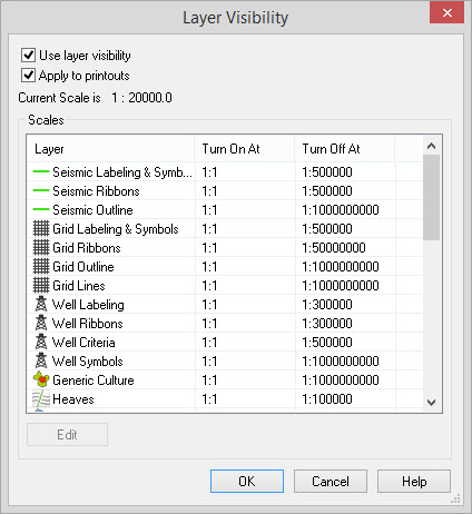
Enable Layer Visibility
Apply to printouts: By default, layer visibility only affects the screen output. This was done to improve map performance while interpreting. To ensure a WYSIWYG approach, you should check this feature on. When checked on all hard copy will appear the same as on the monitor.
Scales List
Select an item to edit the scale at which it turns on or off.
Edit: Use this to change
either the "Turn On
At" or "Turn Off At" map scales.
— MORE INFORMATION

|
Copyright © 2020 | SeisWare International Inc. | All rights reserved |