Well Tops Calculator: Options
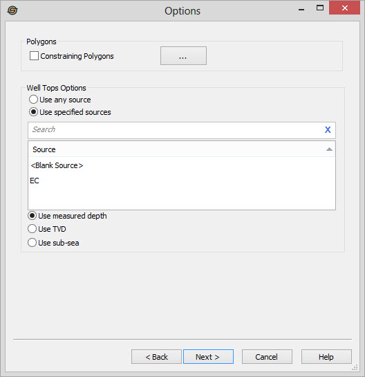
Use the Options page to specify several options for well top
calculations.
Polygons
Constraining Polygons: Turn on constraining polygons to limit the wells used in the calculation.
 Polygons:
Open the Select Polygons
dialog to
select inclusion or exclusion polygons to limit the wells used in the
calculation by geographical area.
Polygons:
Open the Select Polygons
dialog to
select inclusion or exclusion polygons to limit the wells used in the
calculation by geographical area.
Well Tops Options
Use any source: The calculation will be performed on the first top it encounters in the database.
Use specified source: Select one or more sources from the list to limit the tops being used in the calculation. Multiple sources can be selected using the Ctrl key on your keyboard. Only tops with the selected sources will be used in the tops calculation.
Depth Reference
Use Measured Depth: Perform calculations on the well top values as measured depth.
Use TVD: Perform calculations on the well top values as true vertical depth.
Use Subsea: Perform
calculations on the well top values converted to subsea.
— MORE INFORMATION

|
Copyright © 2020 | SeisWare International Inc. | All rights reserved |